Need to Know Info & Travel In & Around Wickham Market
How to get to Wickham Market Suffolk
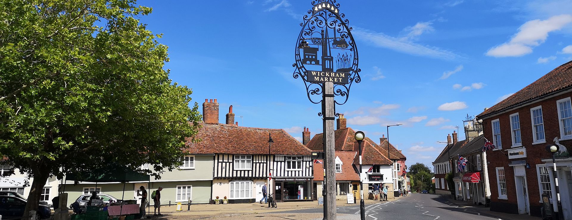
Your travel guide for Wickham Market, Woodbridge and the Suffolk Heritage Coast
All the practical travel info, maps, car parking info and insider tips you need for about getting around Wickham Market . Close to the A12, Wickham Market station, waymarked National Cycle Network routes, and with scheduled and pre-bookable bus services, Wickham Market village is the perfect off-the-beaten-track base for exploring both the Suffolk countryside and the Heritage Coast.
Map of Wickham Market
Towns, Cities & Local Attractions
Ipswich: 13 miles / 21 kms
Norwich: 42 miles / 68 kms
London: 98 miles / 156 kms
Campsea Ashe (nearest train Station): 2.5 miles / 4 kms
- Framlingham Castle (EH) & Town: 6.5 miles / 10 kms
- Snape Maltings: 7.5 miles /12 kms
- Orford & Orford Castle (EH) : 10 miles / 16 kms
- Sutton Hoo (NT): 5 miles / 8 kms
- Woodbridge & its Tide Mill: 5 miles / 8 kms
- RSPB Minsmere: 17 miles / 27 kms
Nearby Towns & Villages
SUFFOLK HERITAGE COAST – TOWNS & BEACHES
Aldeburgh / Thorpeness : 13 miles / 21 kms
Southwold : 22 miles / 35 kms
Dunwich: 17 miles / 27 kms
Lowestoft: 32 miles / 52 kms
Felixstowe: 19 miles / 30 kms
SUFFOLK’S DEBEN VALLEY
Easton / Letheringham: : 2.5 /4 miles – 4/ 6 kms
Debenham: 14 miles / 22 kms
Woodbridge : 5 miles / 8 kms
Your getting around Wickham Market & Area Guide
From Ipswich Suffolk / From London: A12 north, exit onto the B1438 (or B1078, signed for Wickham Market and Framlingham)
From Norwich Norfolk: A140, then the A1120 via Framlingham.
From Cambridge: A14 east- A140 (signed for Norwich) to pick up the B1078 (right) almost immediately.
From Lowestoft Suffolk: A12 south, exit onto B1078 (signed Wickham Market and Framlingham)
See map for public car parks in /around the village centre. There is also limited street parking around The Hill.
The local East of England Cooperative Supermarket on the High Street (B1438) has a customer car park.
Most public car parks support local shops and facilities by offering the first hour / part of hour free of charge. Wherever parking is chargeable, it is payable in cash or via East Suffolk Council’s RingGo app.
Free to download, the ‘RingGo’ parking service app from East Suffolk Council helps locate parking spaces at selected vilalge and town centre car parks. Pay online for parking sessions using the app, or to extend your ticket time (subject to local restrictions). Car registration number and payment details are required for sign up.
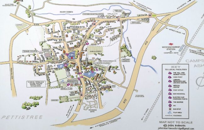
Where to park in Wickham Market
The map of Wickham Market indicates public car parks in /around the village centre. There is also limited street parking around The Hill.
Most public car parks support local shops and facilities by offering the half hour or full hour free of charge. Wherever parking is chargeable, it is payable in cash or via East Suffolk Council’s free-to-download online payment/ extend your parking session app – RingGo.
Short stay public car parks:
- The Hill (market square) IP13 0RA – limited spaces
- Chapel Lane (adjacent to Medical Centre, Library and Resource Centre) IP13 0SB
Long stay parking is at:
- Crafters Car Park – Behind 46-50 High Street IP13 0QS – entrance between Belissima Beauty and East Anglian Traditional Art Centre
Local bus services connect Wickham Market with Aldeburgh on the coast, plus Woodbridge and Ipswich and a number of local market towns where there are onward connections.
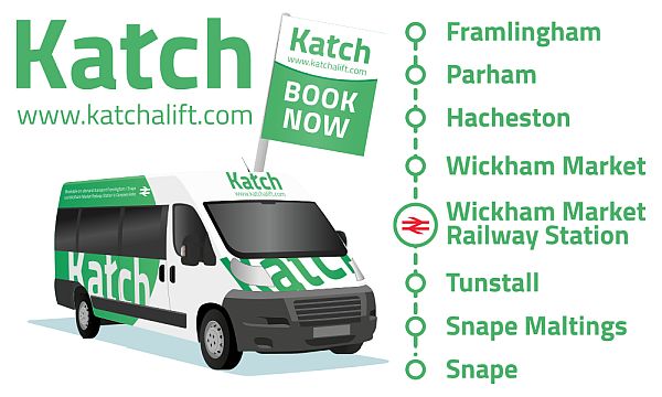
The demand responsive Katch Bus service links Wickham Market with Wickham Market Railway Station (2 miles) and Snape (via Tunstall), as well as Framlingham (via Hacheston and Parham).
It serves fixed stops along a single route, including popular places to visit, Framlingham Castle and Snape Maltings. Fares are in line with normal bus services. Book by phone or app.
Nearest railway station:Wickham Market Station is located 2 miles from the village centre, in Campsea Ashe. It is located on the East Suffolk Line.
Regular Greater Anglia service to Ipswich with connections to London (Liverpool Street), and to Lowestoft with connections to Norwich.
Info, Tickets, Timetables: Greater Anglia
The East Suffolk Line includes stations (north) to Lowestoft and (south) to Ipswich. Connecting services to Norwich, Cambridge and London.
The demand responsive Katch Bus service links Wickham Market with Campsea Ashe for Wickham Market Railway Station (2 miles) . Fares are in line with normal bus services. Book by phone or app.
A number of taxi and private hire businesses operate in and around the Wickham Market area:
- Taxi James (Wickham Market) – 07544 100604
- M & R Cars – Woodbridge – 01394 386191 / 386661 or 0800 169 4269
- Katch Bus Service – A demand responsive transport service. Perfect to get the bus from Wickham Market village to Campsea Ashe for Wickham Market train station , or local villages. Handy service for walkers / visitors. The route includes Framlingham Castle and Snape Maltings. Fares are in line with normal bus services. Book by phone or app.
Community transport services operating in and around the Wickham Market area include the Katch Bus Service, a demand responsive transport service. It has fixed pick up points in helpful locations and can enable people with mobility issues to visit the shops, go to doctor’s appointments or simply get out and about. Fares are in line with normal bus services. Book by phone or app.
The service also runs from Wickham Market village to Campsea Ashe for Wickham Market train station.
Wickham Market is only a short detour from Regional Cycle Routes 41 and the Suffolk Coastal Cycle Path and new round-Suffolk cycle route, The Wolf Way.
Regional Route 41 connects to National Cycle Route 1 and loops to the coast (Aldeburgh and Felixstowe) via Framlingham, Snape Maltings and Woodbridge. The Sustrans website gives access to national and regional cycle network details and mapping.
Cycle rests for locking up your bike in Wickham Market are on The Hill adjacent to the bus shelter.
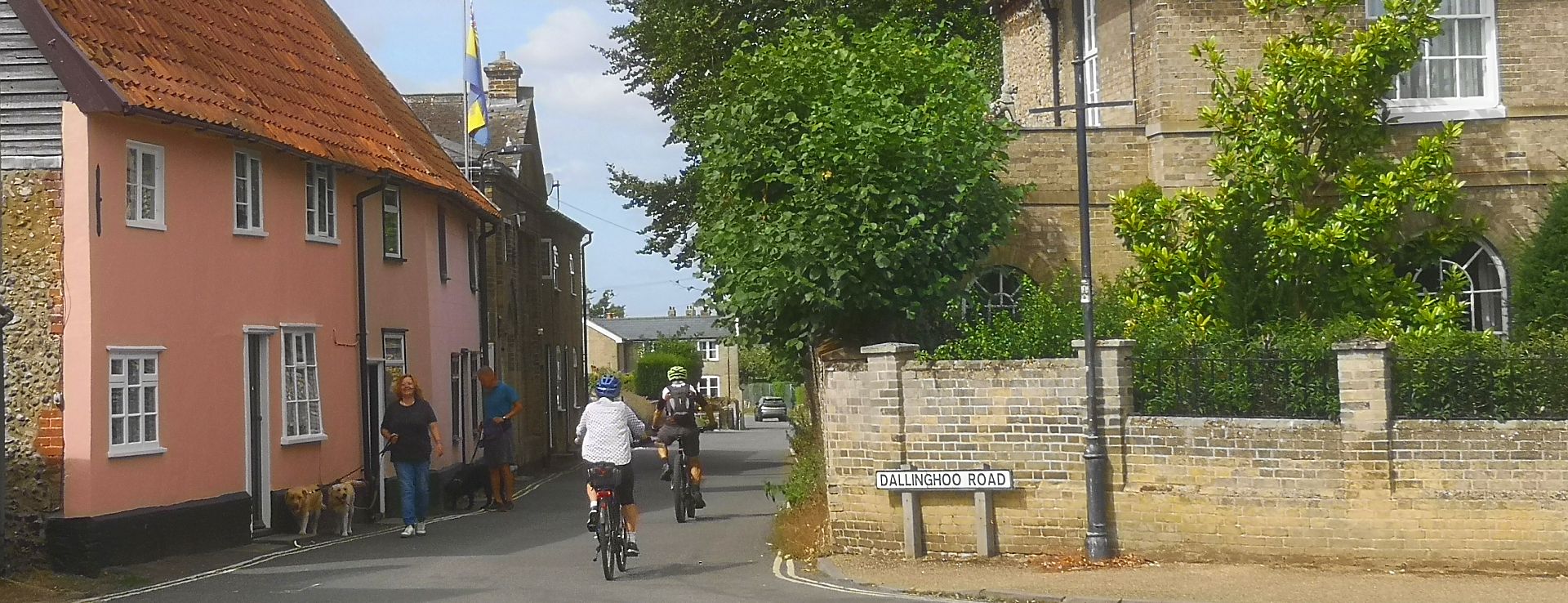
Wickham Market has a network of signed footpaths and bridleways, including a waymarked circular walk around the village.
There are a host of Wickham Market village trails, heritage trails and linear or circular walks from the village to follow via leaflets/ downloads/ digital apps available through this website.
There are also fully waymarked Station to Station linear Walks from Campsea Ashe (for Wickham Market railway station), 2 miles from Wickham Market village.
Where to find Visitor Information in Wickham Market
The library and a number of shops, cafés, pubs, restaurants and the supermarket in Wickham Market village centre distribute copies of local leaflets for places to visit /events.
This includes printed copies of the free Pocket Guide to Wickham Market for maps, trails and useful information.
Looking for East Suffolk-wide visitor information?
Check out The Suffolk Coast website.

Public toilets in Wickham Market are located in Crafters Car Park (Behind 46-50 High Street) IP13 0QS, accessible from The Hill (market square) and on foot from the village hall field /recreation ground.
Historic All Saints’ church in Wickham Market is open for worship and those who wish to visit. Unfortunately the octagonal bell tower is not open to the public.
Wickham Market is a traditional Suffolk market village with independent shops. A number of the shops and the supermarket open on Sundays, along with some of the local cafés and restaurants.
Yes, there is a cash machine on the outside of Wickham Market Cooperative supermarket.